
Gary D Real Estate Photography · East Texas
Real Estate Drone Photography in Tyler, TX
Show the complete property—not just the front door. Professional aerial photography, property video and land boundary overlays for homes, acreage, ranches, waterfront listings and commercial real estate.
Tyler-based · Serving Holly Lake Ranch, Bullard, Lindale, Longview & beyond
More Context. Better Presentation.
Give buyers the view they can't get from the driveway.
Aerial media reveals the scale of a property, the setting around it and features that standard ground-level photography often misses.
Whether you're presenting a lakefront home, showcasing pasture and timber, or marketing a large commercial site, we plan the aerial angles around what makes the property worth seeing.
Work with one local media partner for drone imagery, interior and exterior photography, video and polished listing presentation.
Explore Our Aerial Work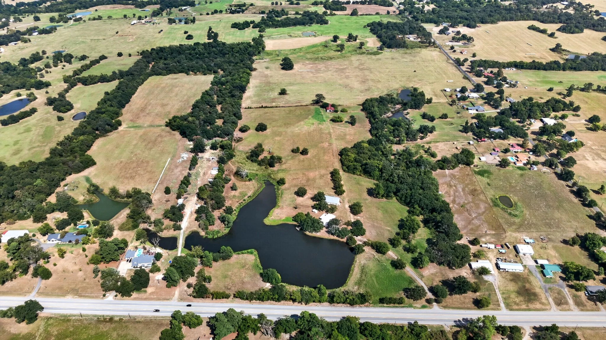
The land, layout and setting—all in one frame.
Aerial Media Services
One drone partner. More ways to show the property.
Purposeful aerial coverage for Realtors, landowners, builders and businesses throughout East Texas.
Residential & Luxury
Elevated views of homes, grounds, pools, outbuildings and neighborhood context.
Land, Ranch & Acreage
Communicate access, topography, ponds, timber, improvements and how the acreage connects.
Waterfront Properties
Show shoreline, docks, boathouses, proximity to water and the broader setting.
Commercial & Development
Present large sites, buildings, parking, frontage and surrounding infrastructure.
Real Projects. Real Aerial Images.
Explore the view from above.
Selected drone photography from Gary D's East Texas property work. Select a photo for a larger view.
All imagery shown is actual client-property photography. Boundary graphics are visual marketing aids, not surveys.
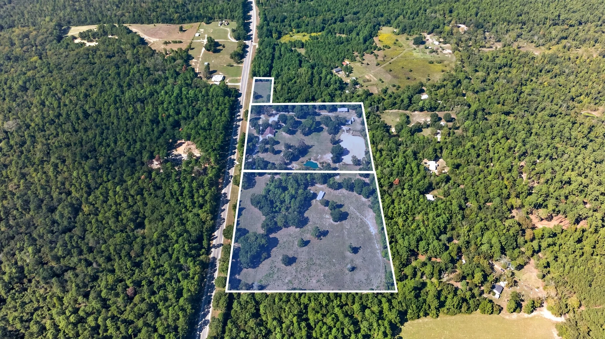
A Clearer Picture of the Property
Property boundary lines included with land aerial coverage.
Buyers need to understand more than acreage on paper. Our visual boundary overlays help connect the parcel information to the land they can actually see.
- Illustrative property outline on selected aerial views
- Helpful context for road access, terrain and neighboring land
- Included when suitable property boundary information is available; custom multi-parcel mapping quoted separately
*Approximate boundary overlays are provided for marketing visualization only and do not establish legal boundaries. Survey and parcel data take precedence.
Beyond the Still ImageBook Drone Photo + Video
Aerial video that lets the property unfold.
Some properties need motion to communicate the journey: the approach, the surrounding land, the relationship between the home and the water, and the full setting buyers want to experience.
Add aerial footage to a listing video or request a custom drone-video project for acreage, commercial property or development marketing.
For listing videoSupporting footage that shows the entire property
For social mediaVertical aerial highlights for mobile viewers
Featured clip: original property aerial footage, optimized as a shorter website preview.
Simple Ways To Get Started
Aerial coverage that fits the property.
From a few powerful listing views to complete property marketing, choose the scope that makes sense.
Aerial Photography
+$100
Add aerial still photography to your residential listing photo package.
Add to a ListingAerial Photos + Video
+$175
Combine still aerial images with drone video as an add-on to your listing media.
Book Listing MediaLand, Ranch & Commercial
Custom
Aerial-only shoots, acreage coverage, boundary overlays, large parcels and special projects scoped to the property.
Request a QuoteAdd-on pricing applies when booked with eligible residential listing photography. Travel, property size and special mapping requirements can affect custom estimates.
Serving Tyler & East Texas
A local aerial media partner for your market.
Based in the Tyler area, we photograph properties across East Texas. Contact us about locations beyond the communities listed here.
TylerHolly Lake RanchBullardFlintLindaleWhitehouseLongviewCantonPalestineGilmerJacksonvilleHenderson
Common Questions
Drone photography FAQs.
Helpful answers for Realtors, sellers and landowners planning aerial media.
Do you provide real estate drone photography in Tyler, Texas?
Yes. Gary D Real Estate Photography provides aerial photography for residential listings, acreage, ranches, waterfront properties and commercial properties in Tyler and surrounding East Texas communities.
Are property boundary lines included with aerial land photography?
A visual boundary-line overlay is included with our land and acreage aerial photography service when reliable parcel information is available. The overlay is an illustrative marketing aid, not a legal survey. Complex multi-parcel mapping may require a custom quote.
Can I book drone photography without interior photography?
Yes. Request a custom quote for aerial-only photography, video, land or commercial projects. Drone coverage can also be added to a full listing media package.
Do you offer aerial video as well as drone photos?
Yes. Aerial video is available on its own or with drone still photography, and it can be incorporated into a larger cinematic property video.
How quickly are aerial photos delivered?
Standard listing media delivery is generally 24–48 hours after the shoot. Timing for large properties, custom overlays and video projects can vary.
What affects the availability of a drone shoot?
Weather, airspace restrictions, property conditions and flight-safety requirements may affect scheduling. We confirm feasibility for each property before flying.
Ready for a Better View?
Show buyers what makes your property worth seeing.
Tell us about your listing, land or commercial property. We'll help choose the right aerial media coverage.